
Business Details
15 Years
experience
Emergency
services
Chartered Land Surveyors in Ashford, Kent
Established in 2011, R L Surveys is a family-run chartered land surveying practice based in Ashford, Kent. With over 20 years of industry experience, our team specialises in delivering precise topographical surveys, measured building surveys, and boundary solutions tailored to client needs. We utilise advanced technologies like 3D laser scanning to ensure unrivalled data accuracy while maintaining traditional surveying standards. Our expertise extends to structural and landform monitoring projects, offering fixed-fee programmes with repeatable methodologies. Operating across Kent, London, Essex, Sussex, and Surrey, we combine local knowledge with nationwide capability to provide competitive tenders for UK-wide projects. Our commitment to professional indemnity insurance, rigorous training, and transparent client communication underscores our regulated status. As MRICS and MCInstCES accredited professionals, we bring technical excellence to diverse projects, from flood defences to architectural developments, ensuring compliance with Ordnance Survey Mapping and Land Registry requirements.
Services
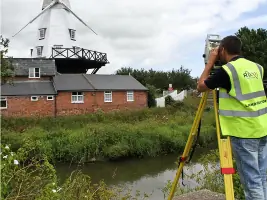
Land/Topographical Surveying
Measured Building Surveys
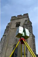
3D Laser Scanning
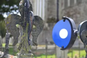
Boundary Issues
Structural Monitoring
Served areas
- London, Kent, Essex, Surrey and Sussex
Details
- Year established: 2011
Highlights and features
- We offer 20+ years of RICS-accredited surveying expertise
- Family-run business ensuring consistent project management
- Invested in Leica C10 ScanStation 3D laser technology
- Provide fixed-fee monitoring programmes with repeatable results
- Cover Kent, London, Essex, Sussex and Surrey with rapid response
Associations and certifications
- Royal Institution of Chartered Surveyors (MRICS)
- Chartered Institute of Civil Engineering Surveyors (MCInstCES)
Services
Land/Topographical Surveying
Our land surveyors create detailed 2D/3D plans for construction projects using traditional and laser scanning methods. We provide accurate terrain models and elevation data for developers and planners. Our surveys support infrastructure projects, environmental assessments and property boundary documentation.
3D Laser Scanning
Using Leica C10 technology, we capture millions of data points per second to create precise 3D models. This non-intrusive method works in varied weather conditions for architectural, engineering and heritage projects. Point cloud data enables detailed analysis of structures and surfaces without physical contact.
Boundary Issues
We resolve property boundary disputes using GPS and total station surveys cross-referenced with Ordnance Survey maps. Our services include lease plans, land subdivision and title registration to prevent future conflicts. We provide expert testimony when required.
Measured Building Surveys
Our team produces accurate floor plans, elevations and cross-sections for existing structures. These surveys support renovation projects, space planning and building information modelling. We use laser technology to capture internal dimensions with millimetre precision.
Structural Monitoring
We implement accuracy-focused monitoring systems for short-term and long-term projects. Our repeatable methodology tracks structural movement, coastal erosion and infrastructure stability. Fixed-fee programmes include flood defence monitoring and annual beach profile assessments.
People
Mike Holiday
Chartered Land Surveyor
BSc holder with MRICS and MCInstCES accreditations, Mike has 20+ years of experience in topographical, hydrographical and boundary surveys. He has worked on major UK developments and provides expert boundary dispute resolution.
Questions
What surveying services do you specialise in?
We specialise in land/topographical surveys, measured building surveys, 3D laser scanning, boundary resolution, and structural/landform monitoring projects.
How experienced is your team?
Our chartered surveyors hold MRICS and MCInstCES accreditations with over 20 years of post-qualification experience across UK construction projects.
Which areas do you cover?
We operate throughout Kent, London, Essex, Sussex and Surrey, with nationwide tender capabilities for UK-based projects.
Do you offer emergency monitoring services?
Yes, we provide rapid response monitoring with same-team site visits to ensure measurement consistency and accuracy.
What technology do you use?
We utilise Leica C10 ScanStation 3D laser scanning technology alongside GPS and total stations for precise data collection.
Reviews (3)
Panos Stavroulis
Aug 04, 2021
Report
I just saw the review by Mr Guo, who appears to also write on my behalf (his neighbour)!. I certainly don't endorse the views of Mr Guo. Mike the surveyor has got specialist equipment that links to GPS and satellites to map your property. We used him for a boundary dispute with my neighbour. Mike produced a report of around 15 pages, going into extreme detail. He was also very patient with my neighbour who did not like the boundary decision and spent more time than expected on our case. Very professional and top quality Leica equipment. Thank you.
Gang Guo
Jul 26, 2021
Report
Avoid! He gave us( neighbor and I) a decision on site, and then U turned when he delivered the report, after pointed out his mistakes, he has very strong ego to admit any of them, and decided he is the god. There is no dimensions in his plan, all lines are bended and massaged, even when you pointed out for him, he found all different excuses.
Steve Jasd
Feb 06, 2021
Report
A superb company and very nice people. Somehow we managed to pay their invoice twice without noticing. RL Surveys called us to let us know and refunded the double payment immediately. Very honest people. Thank you.