
Business Details
32 Years
experience
Expert 2D & 3D Measurement Surveys for Construction & Development
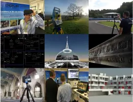
Cadplan Services has been a leader in 2D and 3D measurement solutions since 1994, pioneering the use of 3D laser scanning technology to deliver precise building documentation. Our expertise spans measured building surveys, topographic surveys, and BIM-compliant 3D modelling, serving commercial, residential, and public sector clients across the UK and internationally. With over 25 years of experience, we combine advanced technology with skilled professionals to provide accurate, timely deliverables for construction, refurbishment, and facilities management projects. Our commitment to innovation ensures clients benefit from reduced site visits, enhanced data accuracy, and efficient project workflows.We specialise in underground utility surveys, rights of light assessments, and lease plans, supporting architects, contractors, and property owners through every project phase. Our teams technical proficiency and dedication to client collaboration have solidified our reputation as a trusted measurement surveying partner. By continuously adopting emerging technologies, we maintain industry leadership while upholding rigorous quality standards. From initial data capture to final Revit models, we prioritise precision and reliability to meet evolving client needs.
Services
Measured Building Surveys
Topographic Surveys
3D Laser Scanning
3D Revit Models
Underground Utility Surveys
Rights of Light Surveys
Lease Plans
Land Registry Plans
Details
- Year established: 1994
Highlights and features
- We have over 25 years of experience in measurement surveying.
- We utilise advanced 3D laser scanning technology for accuracy.
- We serve commercial, residential, and public sector clients.
- We deliver projects on time and on budget.
- Our team provides BIM-compliant 3D Revit models.
Services
3D Laser Scanning
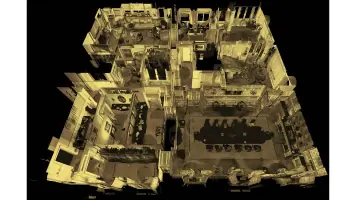
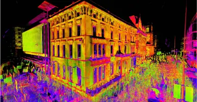
3D Laser Scanning captures precise spatial data rapidly and safely, minimising site revisits. We use time-of-flight and phase-based scanners to produce detailed point clouds for BIM models, ensuring accuracy for complex architectural and engineering projects. Our expertise supports construction, refurbishment, and heritage preservation.
Measured Building Surveys
Measured Building Surveys provide detailed architectural drawings of existing structures. We combine traditional and laser scanning methods to create floor plans, elevations, and sections for property management, renovations, or legal documentation. Our surveys meet strict industry standards for reliability.
3D Revit Models
3D Revit Models convert survey data into BIM-compliant digital representations. These models support construction planning, asset management, and design coordination. We integrate point cloud data to ensure geometric accuracy, aiding architects and engineers in project visualisation and execution.
Underground Utility Surveys
Underground Utility Surveys map hidden infrastructure like pipes and cables. Using non-invasive detection tools, we identify service locations to prevent damage during construction. This service ensures safety, compliance, and informed planning for site development projects.
Rights of Light Surveys
Rights of Light Surveys evaluate potential impacts of new developments on existing daylight access. We provide technical analysis to resolve disputes and ensure compliance with legal standards. This service supports developers and property owners in urban planning contexts.
People
Gareth Edwards
Managing Director
Gareth Edwards founded Cadplan Services in 1994 and has driven its growth into a leading UK measurement surveying firm. With over 30 years in the industry, he champions technological innovation and client-focused solutions.
Colin Dunlop
Survey Manager
Colin Dunlop oversees survey operations, ensuring technical excellence across projects. His expertise in laser scanning and BIM integration enhances data accuracy and project efficiency for complex developments.
Mark Rosier
Cost Manager
Mark Rosier manages financial planning and client budgeting. His strategic approach ensures cost-effective survey solutions while maintaining high standards of service delivery.
Polly Davis
Administration Manager
Polly Davis coordinates administrative operations, ensuring seamless project coordination and client communication. Her organisational skills support the teams efficiency and client satisfaction.
Questions
What services does Cadplan Services offer?
We specialise in 3D laser scanning, measured building surveys, BIM modelling, underground utility surveys, and rights of light assessments.
How long has Cadplan Services been in business?
We have over 25 years of experience, established in 1994 as a leading UK measurement surveying company.
Do you work outside the UK?
Yes, we deliver projects internationally alongside our UK-based clients.
What industries do you serve?
We support construction, property development, public sector, and heritage sectors with precise surveying solutions.
How do you ensure survey accuracy?
We use advanced laser scanning technology and employ experienced professionals to maintain rigorous quality standards.
Videos