
Business Details
24 Years
experience
Emergency
services
3D Laser Scanning & Surveying Services in Macclesfield
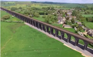
Established in 2002, ScanTech International has become a leading provider of 3D laser scanning, BIM surveys, and drone surveying services across the UK. Our expertise spans critical sectors including nuclear, energy, transport, and heritage infrastructure, delivering precise as-built data for complex projects. With advanced technology such as the Leica RTC360 and RIEGL VZ-600i scanners, we combine technical precision with a client-focused approach to meet project-specific needs. Our team prioritises understanding client requirements, ensuring solutions align with engineering and architectural standards while maintaining a 5mm accuracy benchmark. Over two decades, we have completed high-profile projects like the Harringworth Viaduct and Manchester Airport Terminal 2 renovations, demonstrating our ability to handle time-sensitive and technically demanding tasks.Our deliverables include 3D models, topographical surveys, and clash detection reports, utilised by clients such as Morgan Sindall and COWI. Headquartered in Macclesfield, we serve locations including Manchester, London, and Liverpool, offering nationwide coverage with rapid response capabilities. Our commitment to innovation is reflected in our adoption of real-time registration and automated data processing technologies. We maintain transparency through fixed pricing structures and collaborate closely with clients to ensure deliverables meet exact specifications. Recognised for our role in pioneering 3D scanning adoption in the UK, we continue to invest in staff training and equipment upgrades to maintain industry leadership.

Services
3D Laser Scanning
BIM Surveys
Drone Surveying
Topographical Surveys
Railway Surveys
Heritage Surveys
Airport Surveys
Process Plant Surveys
Details
- Year established: 2002
Highlights and features
- 20+ years pioneering 3D scanning solutions across critical infrastructure
- Advanced scanners deliver 3mm accuracy at 50m range
- Proven track record with complex projects like railway viaducts and airport expansions
- Real-time data registration reduces rework by 40%
- Tailored deliverables compatible with Revit, AutoCAD, and GIS platforms
What people say
Fantastic time management
Quality deliverables
Reduced site visits
Expert technical support
Accurate 3D models
Services
3D Laser Scanning
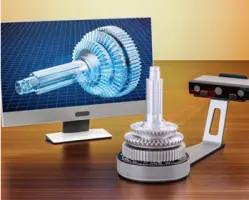
Our 3D laser scanning captures structures with 3mm accuracy at 50m range using Leica RTC360 and RIEGL VZ-600i scanners. This non-contact technology creates detailed point clouds for engineering analysis, heritage preservation, and BIM integration. Clients benefit from reduced site time and precise as-built documentation for complex infrastructure projects.
BIM Surveys
We generate Level of Detail 4 BIM models from point cloud data, enabling accurate design coordination for new builds and renovations. Our Revit models support clash detection and construction planning, particularly valuable for projects like Manchester Airport's terminal expansion. This service ensures design intent aligns with existing conditions.
Drone Surveying
Our UAV surveys capture hard-to-reach areas with 2cm ground sample distance accuracy. This technology creates orthomosaics and 3D models for site analysis, volume calculations, and progress monitoring. Clients use this data for railway infrastructure assessments and large-scale land developments.
Topographical Surveys
We combine traditional EDM measurements with laser scanning to produce OS-grid referenced topographical plans. This service supports civil engineering projects by mapping terrain features, utilities, and boundaries with 5mm accuracy. Clients use these surveys for drainage planning and site development.
Railway Surveys
Specialising in rail infrastructure, we conduct track geometry surveys and asset inspections using laser scanning and drones. Our solutions help maintain clearance standards and plan upgrades for stations and tunnels. Clients benefit from minimal disruption during data collection on live networks.
People
Keith McCrory
Managing Director
Keith founded ScanTech International in 2002 after developing the business plan and securing bank financing. With engineering expertise, he has led the company's growth into a leading 3D surveying firm, pioneering laser scanning adoption across UK infrastructure projects.
Questions
What industries do you specialise in?
We focus on transport infrastructure, energy facilities, heritage sites, and process plants requiring precise as-built data.
How does 3D laser scanning benefit construction projects?
It reduces site time by 80%, improves design accuracy, and enables clash detection before construction begins.
Can you handle urgent survey requests?
Yes, we provide emergency callouts with rapid mobilisation, as demonstrated during the 2023 Plessey Viaduct collapse.
What deliverables do you provide?
We supply 3D point clouds, Revit models, topographical drawings, and custom GIS-compatible datasets.
Are your surveys suitable for listed buildings?
Yes, our non-invasive scanning preserves heritage integrity while capturing detailed structural data.
Videos