
Business Details
39 Years
experience
Expert Surveying Services in Leicester
Established in 1987, Ratcliff Land Surveys has built a strong reputation for excellence in the surveying industry. Our team of friendly, professional surveyors is committed to delivering the highest standard of service, ensuring every project is completed with precision and accuracy. Over the years, we have become a trusted name, providing reliable results to clients across a wide range of sectors. In 2013, we became part of SML Group Ltd, enhancing our services and expanding our competitive coverage across the UK. In 2024, we joined SML Geospatial, a specialist arm of SML Group, enabling us to offer even more comprehensive, innovative, and reliable surveying services nationwide. Our expertise spans 2D/3D topographic surveys, measured building surveys, setting out for construction, and underground utility surveys.We utilise state-of-the-art methods to ensure accuracy and efficiency, offering fixed fee quotes to make projects cost-effective. Our nationwide coverage allows us to deliver tailored solutions, paying close attention to client requirements while maintaining clear communication and professional methodologies. We pride ourselves on flexibility, quick reaction times, and a dedication to meeting strict deadlines, as demonstrated in major projects like the Kings Lynn piling scheme. Our partnership with SML Group and commitment to quality control ensures we remain a leader in the industry.
Services
Topographic Surveys
Measured Building Surveys
Setting Out Services
Utility Surveys
Hydrographic Surveys
Monitoring Surveys
CCTV Drainage Surveys
PAS128 Surveys
GPR Surveys
Flood Risk Surveys
Details
- Year established: 1987
Highlights and features
- We have over 35 years of experience in land surveying across diverse sectors.
- Our nationwide coverage ensures accessibility and reliability for UK projects.
- We utilise state-of-the-art technology for accurate and efficient surveying solutions.
- Fixed fee quotations provide cost-effectiveness and transparency for clients.
- Our team maintains clear communication and adapts swiftly to project changes.
What people say
Accurate results
Professional team
Timely delivery
Cost-effective solutions
Excellent communication
Services
Topographic Surveys
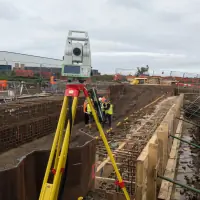
Our topographic surveys provide detailed 2D/3D representations of terrain and features for major infrastructure projects. Using advanced equipment, we ensure precise data collection for road, housing, and hydraulic modelling applications. This service supports informed planning and design decisions with accurate elevation and contour data.
Measured Building Surveys
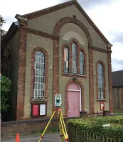
We deliver precise measured building surveys for regulatory compliance and renovation projects. Our team creates detailed floor plans, elevations, and sections using laser scanning technology. This ensures accurate documentation of existing structures for building regulation drawings and asset management.
Setting Out Services
Our setting out services guide construction projects with millimetre accuracy. Using GPS and total stations, we establish reference points for roads, pipelines, and steel frames. This ensures alignment with design specifications, preventing costly errors during infrastructure development.
Utility Surveys
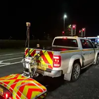
We conduct PAS128-compliant utility surveys to locate buried services using ground-penetrating radar and electromagnetic detection. This service identifies water, gas, and electrical networks to prevent damage during excavation. Our reports reduce project risks and enhance safety for construction teams.
CCTV Drainage Surveys
Our CCTV drainage surveys identify blockages and structural issues in sewer systems. High-resolution cameras inspect pipework condition, enabling targeted maintenance. This service helps prevent flooding and ensures compliance with drainage regulations for commercial and residential properties.
Questions
What surveying services do you offer?
We provide topographic surveys, measured building surveys, utility mapping, setting out, and CCTV drainage inspections across the UK.
How experienced is your team?
Our surveyors have over 35 years of combined experience, with specialists in construction, infrastructure, and utility projects.
Do you operate nationwide?
Yes, as part of SML Geospatial, we offer comprehensive coverage across the UK.
Can you handle urgent projects?
Our team provides rapid response times, as demonstrated in time-sensitive projects like the Kings Lynn piling scheme.
How do you ensure survey accuracy?
We use state-of-the-art GPS, laser scanning, and ground-penetrating radar equipment for precise data collection.
What industries do you serve?
We work with construction firms, civil engineers, and infrastructure developers on residential, commercial, and industrial projects.
Reviews (4)
Alan Stevens
Sep 04, 2021
Report
Excellent service from start to finish, brilliant communication with managers and reception and accounts. The whole Company is on the ball, wish all "professionals" were as professional! Highly recommended. Many Thanks
Anir M.
Apr 05, 2019
Report
Appointed Ratcliff Land Surveys on a few projects with my earlier employers, and used them again recently with my new company. One of the most professional services I would say! The best thing being they would help you reduce your survey project costs by only recommending what's required; and would deliver the surveys beyond your expectations! Highly recommended for Individuals and businesses alike!
Subsidence Monitoring
Nov 07, 2016
Report
We have used this company now on several occasions and have always received fantastic customer service. Our surveys have always been completed and sent to us in a satisfactory time frame. Would definitely recommend.
Aldo Marino
May 28, 2016
Report
I used this company for 3 surveys spending thousands. I paid their account on the understanding they would provide me hard copies of the surveys. 8 weeks later still chasing them for this. Appalling service and promises not respected.