
Business Details
50+ Years
experience
Professional Surveying Services in Ipswich
Established in 1973, we have built a reputation for delivering surveying services of exceptional accuracy and reliability across the UK. Our success stems from a steadfast commitment to precision, cutting-edge technology, and outstanding customer service. With decades of collective experience, our team of skilled professionals utilises state-of-the-art equipment from industry leaders like Leica and Trimble to meet diverse client needs. As members of The Survey Association and holders of UKAS ISO 9001/14001 and SSIP accreditations, we maintain rigorous quality and safety standards. Our client base spans national agencies, high street retailers, architects, and developers, reflecting our ability to adapt to varied project requirements.We prioritise continuous professional development, with staff trained in emergency first aid, asbestos awareness, and lone working protocols. Our comprehensive service portfolio includes land, building, and underground utility surveys, supported by advanced 3D laser scanning and drone technology. Headquartered in Ipswich, we combine regional accessibility with nationwide reach, ensuring timely delivery of tailored solutions. By integrating technical expertise with a client-focused approach, we empower informed decision-making for projects ranging from small residential developments to large-scale infrastructure. Our dedication to innovation, integrity, and long-term client relationships underpins every survey we conduct.
Services
Topographic Surveys
Measured Building Surveys
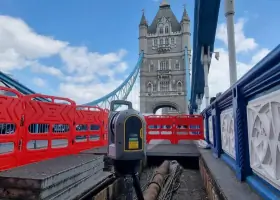
3D Laser Scanning
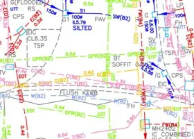
Underground Utility Surveys
Drone Surveys
CCTV Drainage Surveys
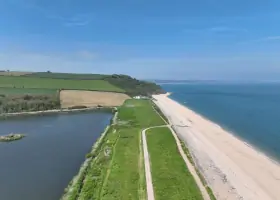
Coastal Surveys
Volume Surveys
Boundary Surveys
Revit Modelling
Details
- Year established: 1973
Highlights and features
- We have over 50 years of experience in professional surveying services.
- Our team utilises state-of-the-art technology from industry leaders like Leica and Trimble.
- We hold UKAS ISO 9001/14001 and SSIP health and safety accreditations.
- Our staff undergo annual CPD-certified training in safety and technical disciplines.
- We serve a diverse client base including national agencies and local developers.
Associations and certifications
- UKAS ISO 9001
- UKAS ISO 14001
- SSIP
Services
Topographic Surveys
We conduct detailed topographic surveys capturing natural and man-made features for projects ranging from small gardens to major infrastructure developments. Our surveys provide precise positional and elevation data using advanced surveying instruments. This information supports planning applications, construction projects, and environmental assessments across the UK.
3D Laser Scanning
Our 3D laser scanning creates millions of data points to form accurate digital representations of physical objects. This technology enables colourised point clouds, 2D/3D CAD plans, and Revit models for building analysis. Ideal for complex structures where traditional methods face accessibility challenges, ensuring comprehensive data capture.
Underground Utility Surveys
We locate and map underground utilities using electromagnetic detection, ground-penetrating radar, and CCTV inspections to PAS128 standards. Our surveys identify sewer, gas, water, and electrical infrastructure to prevent damage during excavation. This service ensures safe and compliant site development across various environments.
Measured Building Surveys
We produce detailed floor plans, elevations, and sections for residential, commercial, and historic buildings using precision measurement tools. Our surveys meet architectural and renovation requirements, capturing existing conditions for redevelopment projects. This service supports planning applications and building compliance assessments.
Drone Surveys
Our UAV surveys capture high-resolution aerial data in challenging environments where traditional methods are impractical. Drones enable rapid, cost-effective site mapping for large areas, infrastructure inspections, and progress monitoring. This technology enhances data collection efficiency while maintaining survey-grade accuracy.
People
Richard Allen
Managing Director
With over 30 years at EDI Surveys, Richard oversees business operations and strategic direction. He joined in 1991 after seismic survey experience overseas and at CERN, becoming MD in 2017. His leadership focuses on maintaining technical excellence and client satisfaction.
Luke Warvill
Director
Luke has driven technical innovation since joining in 1999. As Director since 2018, he develops client relationships and technical strategies while contributing to business growth. His expertise spans surveying technologies and project management for complex developments.
Tina Connor
Director
Tina leads topographic and coastal survey projects with 30+ years' experience. She manages quality assurance systems and business strategy implementation. Her background includes academic surveying qualifications and extensive fieldwork experience across diverse environments.
Adam Rose
Survey Manager
Adam has progressed through EDI since 1994, becoming Survey Manager in 2014. He specialises in coastal surveys and equipment maintenance, combining practical experience with technical oversight of field operations. His career demonstrates long-term commitment to surveying excellence.
Tony Andrews
Survey Manager
Tony leads measured building surveys and laser scanning projects. With surveying expertise since joining in 2008, he specialises in point cloud manipulation and Revit modelling. His academic background in surveying sciences supports technical innovation in building documentation.
Questions
What surveying services do you offer?
We provide topographic, measured building, 3D laser scanning, underground utility, drone, CCTV drainage, coastal, and boundary surveys, along with Revit modelling and volume calculations.
How long have you been in business?
EDI Surveys has delivered professional surveying services across the UK since 1973, with over 50 years of industry experience.
Which areas do you cover?
We operate nationwide throughout the UK, with our headquarters based in Ipswich, Suffolk, providing excellent access to London and the Midlands.
What technology do you use?
We utilise advanced equipment from industry leaders including Leica, Trimble, Vivax, Proceq, vCam, Wingtra, and DJI for precise data collection and analysis.
Are you accredited for quality standards?
Yes, we hold UKAS ISO 9001 (quality management) and ISO 14001 (environmental management) accreditations, along with SSIP health and safety certification.