
Business Details
30 Years
experience
Land Surveying Services in Maidstone
Established in 1996, Sitech Surveying Services has built a reputation for delivering precise and reliable land surveying solutions across the UK, Channel Islands, and overseas. Our expertise spans topographic surveys, measured building surveys, and underground services mapping, supported by cutting-edge technology including reflectorless total stations, GPS systems, and Ground Penetrating Radar. With strategic offices in Maidstone and Cirencester, we serve construction and design professionals nationwide, combining over 50 years of collective experience from our founding directors.Our commitment to quality is reinforced through rigorous adherence to AutoCAD processing standards and comprehensive project record-keeping. We prioritise tailored service delivery, ensuring competitive pricing and timely execution while maintaining full professional indemnity coverage. Our team's extensive background in government and private sector surveying, including international projects in Cyprus, Germany, and Gibraltar, underscores our technical proficiency and adaptability to complex site conditions.
Services
Topographic Surveys
Measured Building Surveys
Underground Services Mapping
3D Laser Scanning
Setting Out Surveys
Details
- Year established: 1996
Highlights and features
- We combine over 50 years of surveying experience from our founding directors
- We utilise the latest reflectorless, GPS, and GPR technologies
- Our services are tailored to specific project requirements
- We maintain full digital and physical project records
- We offer nationwide coverage with strategic regional offices
Associations and certifications
- The Survey Association (TSA)
Services
Topographic Surveys
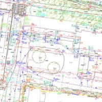
We conduct detailed topographic surveys using reflectorless and GPS technologies for sites with restricted access. Our surveys capture terrain features, elevations, and existing structures to support construction planning and land development projects. Data is delivered in digital or printed formats up to A0 size, processed through the latest AutoCAD software.
Measured Building Surveys
Our measured building surveys provide precise dimensional data for commercial, industrial, and residential properties. Using advanced laser scanning, we create accurate floor plans, elevations, and cross-sections to support space planning, renovations, and asset management. All surveys comply with industry standards for construction professionals.
Underground Services Mapping
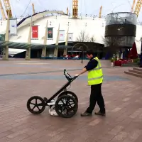
We locate underground utilities using electromagnetic detection and Ground Penetrating Radar (GPR). Our surveys identify cables, pipes, and drainage systems, including non-metallic conduits. Results are marked on-site with biodegradable paint and provided as detailed CAD drawings, following TSA Utility Guidance Note Standards for safety and accuracy.
3D Laser Scanning
Our 3D laser scanning captures high-resolution spatial data for building and land surveys. This technology creates detailed point clouds and BIM-ready models for construction documentation, heritage preservation, and structural analysis. Data integration with AutoCAD ensures seamless project coordination for complex developments.
Setting Out Surveys
We provide setting-out services to establish precise reference points for new construction projects. Using total stations and GPS equipment, our surveyors mark building lines, service routes, and structural elements to ensure accurate implementation of design plans across residential, commercial, and infrastructure developments.
People
Mike Timbrell
Director
With over 30 years' experience in land surveying, Mike founded Sitech Surveying Services in 1996. Previously employed by Central Survey Branch, he specialises in construction surveying and has worked on international projects across Europe and the South Atlantic.
Martin Hegley
Director
Martin brings extensive expertise in AutoCAD applications and field surveying, having worked with Central Survey Branch since 1975. He transitioned to Sitech in 1996, focusing on technical innovation and quality assurance for all survey deliverables.
Questions
What surveying services do you offer?
We provide topographic surveys, measured building surveys, underground utility mapping, 3D laser scanning, and setting-out services for construction professionals.
How long have you been in business?
Sitech Surveying Services has operated since 1996, with our directors collectively holding over 50 years of surveying experience.
Which areas do you cover?
We operate throughout Kent, Surrey, Sussex, London, Bristol, and Gloucestershire, with nationwide and international capabilities including the Channel Islands.
What technologies do you use?
We utilise reflectorless total stations, GPS systems, Ground Penetrating Radar, and the latest AutoCAD software for accurate survey data capture and processing.